Rothesay
Conditions
Scored by DiveConnect's site-physics model
Marine forecast via Copernicus Marine. Score is a rule-based guide from swell/wind vs. the site's exposure — always dive your own assessment.
Dived here today? How were conditions vs. what we showed?
About this site
The Rothesay is a wooden twin side-wheel steamer wreck in the St. Lawrence River at the west edge of Prescott, Ontario, on the south side of Highway 2. It is a shore dive in about 7.6 to 9 m (25 to 30 ft) of water.
Entry is from a park and picnic area, where a staircase leads down to the river's edge. From there a rope system leads out to the wreck, meeting it near the midsection where the rocker arm and paddles can still be seen. The bottom is firm silt with weed growth between the wreck and the shore. Visibility runs 4.6 to 9 m (15 to 30 ft), and there is little current, no thermocline and no boat traffic.
The steamer was launched at St. John, New Brunswick, in 1867 and later worked the Montreal to Prescott run. She sank in September 1889 after colliding with an American tug. In 1901 a Royal Military College group used her for explosives practice, which flattened her midsection, though the stern and bow remain relatively intact.
Marine life here
Confirmed by our research team, reported by independent divers, or observed nearby via iNaturalist — each entry is labelled with its source.
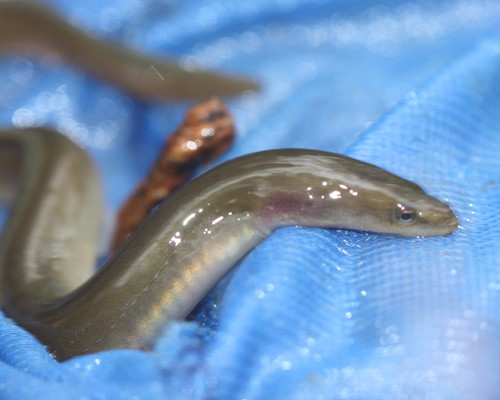 American EelAnguilla rostrataReported here · unconfirmed
Durable tips from divers — access, hazards, marine life, facilities. For day-of conditions, use the report tool in the conditions card above.
No notes yet. Dived here? Be the first to leave a tip.
Share a write-up or a photo. Submissions are reviewed before they appear on the page.
Nearby dive sites
Shops that dive here
No shops have listed this site yet.