Gascony
Conditions & tides
Scored by DiveConnect's site-physics model
Marine forecast via Copernicus Marine. Score is a rule-based guide from swell/wind vs. the site's exposure — always dive your own assessment.
Dived here today? How were conditions vs. what we showed?
About this site
Gascony is a steamship wreck in the English Channel, lying less than 1 nautical mile east of the Owers and about 10 nautical miles south-west of Littlehampton. The seabed is at about 27 m.
On 7 January 1918 Gascony was on a voyage from Southampton to Calais with a cargo of government stores when the German submarine UC75 sank her. There were no casualties.
She is virtually upside-down and has collapsed over to starboard. The largest high point of the wreck is just aft of the boilers, at 25 m. The port side is the more interesting part, marked by intact sections of railing and other deck fittings.
Read the full guideShow less
Heading aft along the port side, a jumble of metal hull plates and railings is broken by the remains of a mast. Further aft, another section of upright railing marks the point where the stern is slightly more intact and rises above the seabed.
Marine life here
Confirmed by our research team, reported by independent divers, or observed nearby via iNaturalist — each entry is labelled with its source.
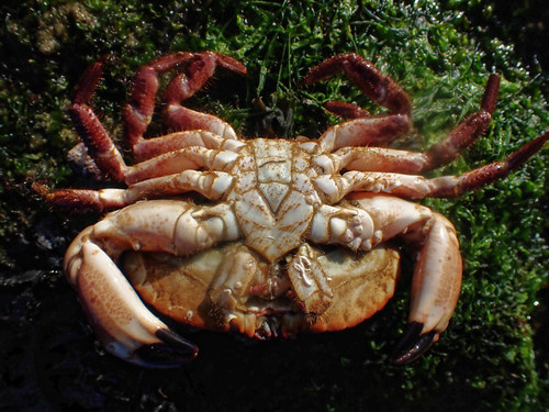 Edible CrabCancer pagurusReported here · unconfirmed
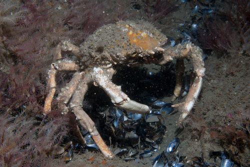 Spiny Spider CrabMaja brachydactylaReported here · unconfirmed
Durable tips from divers — access, hazards, marine life, facilities. For day-of conditions, use the report tool in the conditions card above.
No notes yet. Dived here? Be the first to leave a tip.
Share a write-up or a photo. Submissions are reviewed before they appear on the page.
Nearby dive sites
Shops that dive here
No shops have listed this site yet.
Contains public sector information licensed under the Open Government Licence v3.0. · OGL v3