Sugar Sands Ledges
Conditions & tides
Scored by DiveConnect's site-physics model
Marine forecast via Copernicus Marine. Score is a rule-based guide from swell/wind vs. the site's exposure — always dive your own assessment.
Dived here today? How were conditions vs. what we showed?
About this site
Sugar Sands Ledges is a purpose-built artificial reef inside Lake Worth Lagoon, Palm Beach County, Florida, catalogued by Palm Beach County as site PB-139. It sits on the east side of the lagoon north of Blue Heron Bridge and south of Munyon Island, placing it in the Riviera Beach area rather than in the open Atlantic. The reef consists of 17 discrete ledge structures arranged in a line within the lagoon. The material volume is substantial: approximately 4,665 tons of rock and 16,000 tons of concrete. An additional pilot Marine Living Structures module, a large 10-by-10-foot ecologically engineered unit, has also been deployed at the Sugar Sands site. Palm Beach County's Department of Environmental Resources Management administers the reef as part of the county's broader artificial reef program.
Depth at Sugar Sands Ledges is shallow. Recorded maximum depth on monitoring dives is 24 feet (7.3 metres). The reef runs north to south in roughly 20 feet (6 metres) of water and at times holds snook, permit, grouper, snapper, and spiny lobster. The modest depth means bottom times are essentially unlimited on air, and the site is accessible to Open Water divers and snorkelers alike, though the sheltered lagoon setting means conditions differ meaningfully from the ocean reefs nearby.
Marine life documented across reef-team fish counts is diverse for an inshore lagoon site. A single species tally recorded 72 species from 25 families, including blue, French, gray, and queen angelfish; banded and spotfin butterflyfish; blue chromis; doctorfish, blue tang, and ocean surgeon; and bluehead, Creole, and slippery dick wrasse. The broader Lake Worth Lagoon ecosystem supports sea turtles, manatees, and more than 250 varieties of fish species. The lagoon's sheltered character makes it a nursery habitat, so juveniles of many reef species are frequently present alongside residents.
Read the full guideShow less
The ledges are reached by boat inside the lagoon. The Palm Beach County Reef Research Team has published corrected GPS coordinates for the southeast corners of all 17 individual ledges (Sugar Sands Ledges 1–17), making navigation to specific structures straightforward with a chartplotter.
Conditions inside the lagoon differ from the ocean reefs. Visibility can drop to around 15 feet after heavy rainfall pushes fresh runoff into the lagoon, and a stiff southeast wind can hold the tide and keep ocean boats sheltering in the lagoon, making boat traffic over the ledges intense on rough-weather days. Current on the site has been recorded at roughly 0.1 knots running to the north, light enough to be negligible on most dives. Water stays calm since the site is within Lake Worth Lagoon; going at or near high tide generally produces the clearest, most blue-tinted water.
Hazards at this site are primarily above the surface. Boat traffic over the ledges can be intense, especially when rough ocean conditions push recreational vessels into the lagoon. A dive flag is mandatory under Florida law and essential here; surfacing divers must watch carefully for passing boats before ascending. Visibility can fall sharply after rain events due to freshwater runoff, reducing it to 15 feet or less and making navigation between ledge structures harder. The shallow depth removes any meaningful decompression risk, but the concrete-and-rock structure does present entanglement and abrasion hazards in the ledge crevices. Spiny lobster are present and subject to standard Florida bag and season regulations; take only during the legal season and with the correct gear.
Sugar Sands Ledges suits Open Water-certified divers and confident snorkelers. The 20–24-foot (6–7.3-metre) maximum depth, light current, and calm lagoon surface make it a low-stress environment well within recreational limits. The site is a strong choice for new divers building bottom time, for underwater photographers wanting a relaxed, fish-rich shallow dive, and for anyone wanting a productive dive on days when the Atlantic swell makes the offshore reefs impractical. Visibility expectations should be set realistically, plan around high tide and avoid the day or two after significant rainfall for the best clarity.
Marine life here
Confirmed by our research team, reported by independent divers, or observed nearby via iNaturalist — each entry is labelled with its source.
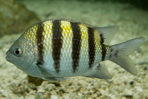 Atlantic Sergeant MajorAbudefduf saxatilisReported here · unconfirmed
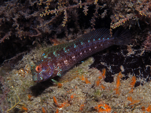 Seaweed BlennyParablennius marmoreusReported here · unconfirmed
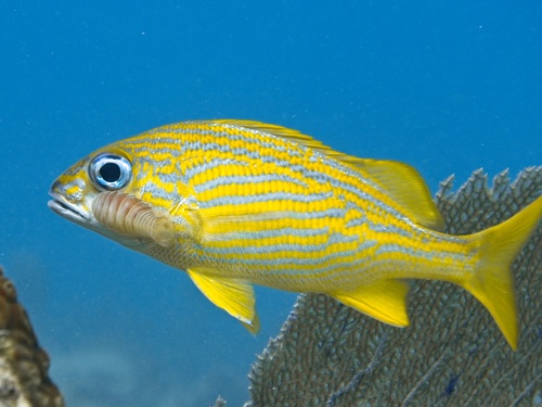 French GruntHaemulon flavolineatumReported here · unconfirmed
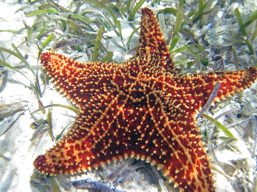 Red Cushion Sea StarOreaster reticulatusReported here · unconfirmed
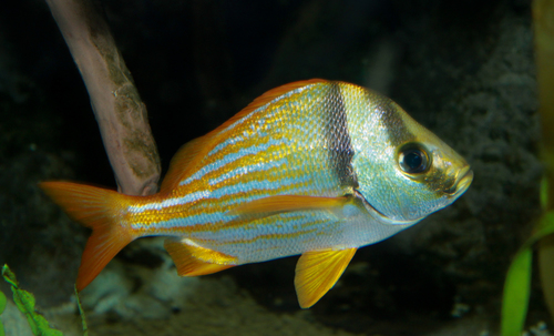 PorkfishAnisotremus virginicusReported here · unconfirmed
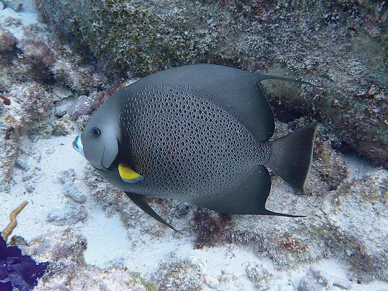 Grey AngelfishPomacanthus arcuatusReported here · unconfirmed
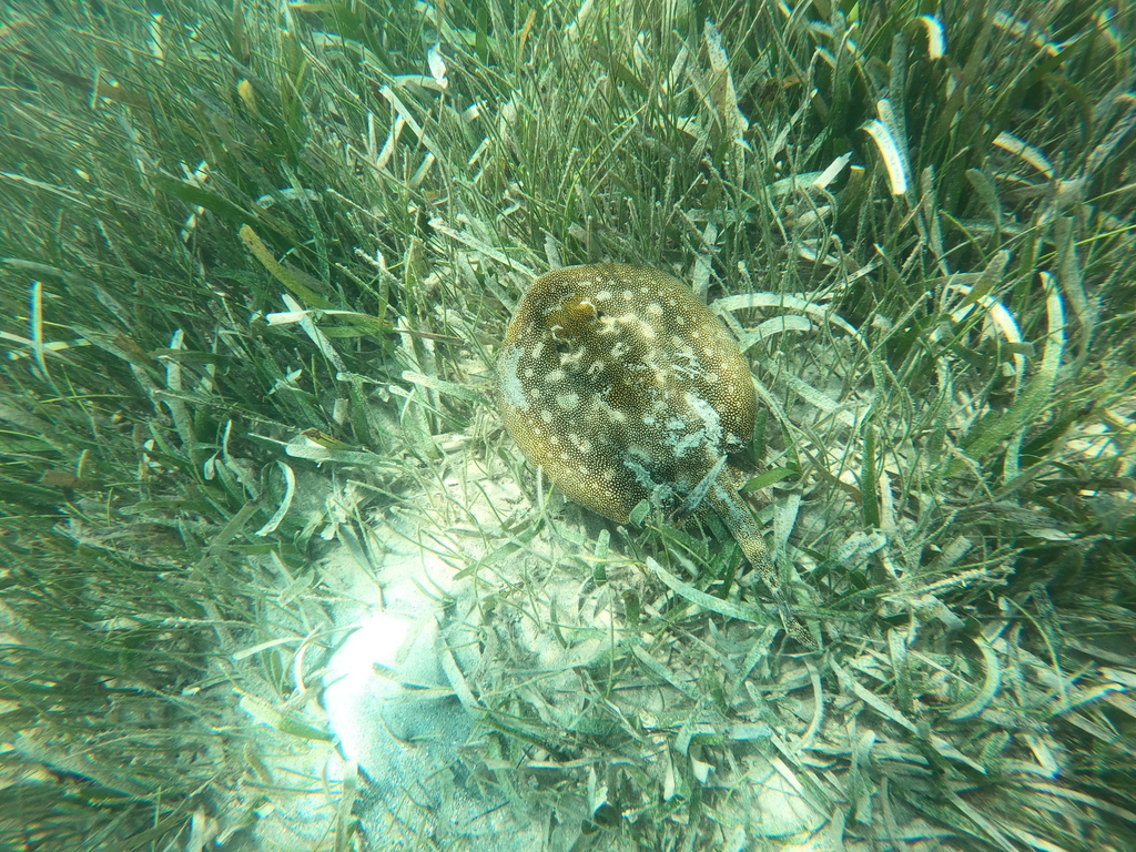 Yellow StingrayUrobatis jamaicensisReported here · unconfirmed
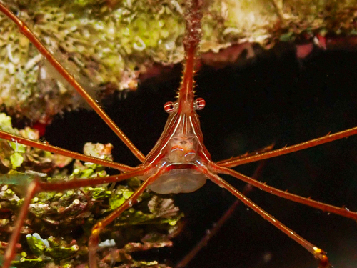 Yellowline Arrow CrabStenorhynchus seticornisReported here · unconfirmed
Durable tips from divers — access, hazards, marine life, facilities. For day-of conditions, use the report tool in the conditions card above.
No notes yet. Dived here? Be the first to leave a tip.
Share a write-up or a photo. Submissions are reviewed before they appear on the page.
Nearby dive sites
Shops that dive here
No shops have listed this site yet.